China Braces for Deepening Impact of Typhoon Dolphin as Central Provinces Prepare for Severe Weather
The powerful tropical storm, Dolphin, has swept across eastern China, causing heavy rain and strong winds, with authorities warning of impending flooding and landslides.
By Global Trend Scope Desk
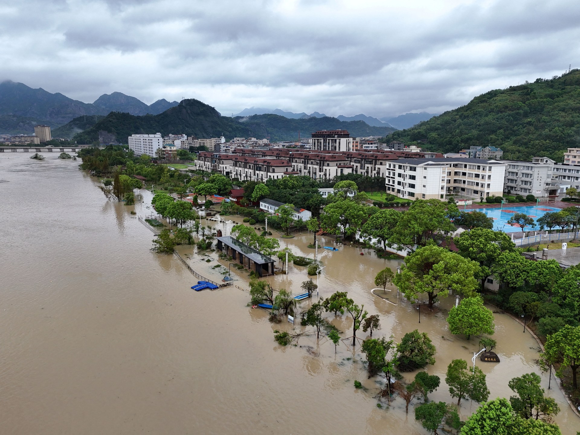
The powerful tropical storm, Dolphin, has swept across eastern China, causing heavy rain and strong winds, with authorities warning of impending flooding and landslides. Initially making landfall in Yuhuan, Zhejiang province as a typhoon on Sunday, Dolphin triggered China’s highest weather alert with maximum sustained winds of 151 kilometers per hour (94mph). The National Meteorological Center (NMC) issued a "red alert" – the highest level in China's typhoon warning system – as Dolphin approached. Over a million residents were evacuated from their homes, with more than 900,000 relocated in Wenzhou alone, 100,000 evacuated in Shanghai, and another 99,000 in neighboring Fujian province. As of Monday, Dolphin had weakened into a tropical storm but continued to drench the eastern provinces, including Anhui, Jiangsu, and Shandong. Forecasters predict torrential rain through August 10 across Zhejiang, Shanghai, northern Fujian, northeastern Jiangxi, central and southern Anhui, and much of Jiangsu, with central and eastern Zhejiang potentially receiving up to 500mm (19.7 inches) of rain. Shanghai's two airports canceled a total of 943 flights due to the typhoon, reducing capacity by nearly 40%. Authorities in Beijing have raised warnings for torrential rain and are prepared to activate its flood control response as the city expects "significant rainfall" from Tuesday until Thursday, potentially leading to flash floods within the city and landslides in surrounding mountainous areas. The storm is forecast to move deeper into central provinces Hubei and Henan in the coming days, pushing moisture northward.
Filed underWorld
More stories
World
Oxford Returns Ancestral Naga Remains to India, Paving Way for Joint Memorial and Burial
Global Trend Scope Desk
World
The Odyssey's Global Journey Grounded: Singapore Seizes Stranded Cruise Ship Amidst Fuel Cost Crisis
Global Trend Scope Desk
World
Global Energy Superpowers Battle for Dominance: Implications on Climate and Consumer Costs
Global Trend Scope Desk
World
Honduras Delays Verdict in Sex-Trafficking Case Amidst Global Concerns Over Impunity
Global Trend Scope Desk
World
Global Diplomacy Intensifies: US Mediates Russia-Ukraine Peace Talks Amid Claims of Battlefield Successes
Global Trend Scope Desk
World
European Diplomats Advocate for Inclusion in Russia-Ukraine Peace Negotiations
Global Trend Scope Desk